Last updated on March 5th, 2023 at 06:21 pm
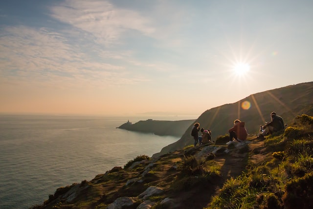
The Howth Cliff Walk around Howth Head peninsula is one of the most exhilarating and beautiful walks in Dublin. Surrounded on almost all sides by the Irish Sea, Howth is connected to the mainland by a narrow strip of land less than 1km across at the North Dublin neighbourhood of Sutton. Named Binn Éadair in Irish (Éadar’s peak, after Étar, the wife of one of the five Fir Bolg chieftains who reportedly died and was buried in Howth), the peninsula is aptly named in the native Irish, with a number of dominant peaks rising from the sea. The elevation offers spectacular views over Dublin Bay, Dublin city, and the beautiful Bailey lighthouse, as well as varied and challenging terrain to keep any hiker interested.
Happily, there are a number of trails to choose from, including quick 2 hour rambles and longer treks for those looking to explore every inch of the peninsula. All trails offer great views as each one hugs the cliffs at several points along the route.
In this post, we share the complete guide to each Howth cliff walk, including maps, parking information, and wildlife you may be lucky enough to encounter.
The Howth cliff walks in a nutshell
Howth Cliff Walk Trails
Somewhat confusingly, there are numerous trails that criss cross Howth Head that are often collectively called the ‘Howth Cliff Walk’. However, in total, there are four officially marked routes that can be taken:
- The Cliff Path loop (Green route)
This route, which follows the green trail markers, is the most popular of the four official trails. The fact that it is the shortest route but still offers excellent views is probably why! This route can be safely tacked by hikers of moderate fitness, as it only rises 130 metres in elevation along the trail. The Cliff Path loop is 8km long and should take about 2.5 hours.
- The Tramline loop (Blue route)
This route, which follows the blue trail markers, is a good trail to take for especially good views of Howth harbour and Ireland’s Eye. Called the Tramline loop because it follows the route of the old Howth tramline that is no longer is in operation, the trail rises 130 metres in elevation along its 7km length, and should take just over 2 hours.
- The Black Linn loop (Red route)
This route, which follows the red trail markers, is mostly over land across Howth Head but does offer good views over the cost of Dublin. The trail rises 160 metres over 8km, and should also take about 2.5 hours.
- The Bog of the Frogs loop (Purple route)
Finally, the Bog of the Frogs loop, which follows the purple trail markers, is the longest route at 12km. Rising 240 metres in elevation, the trail is also the most steep. The far off Wicklow mountains can be seen on this trail, as well as panoramic views over the capital.
Safety and Fitness Requirements
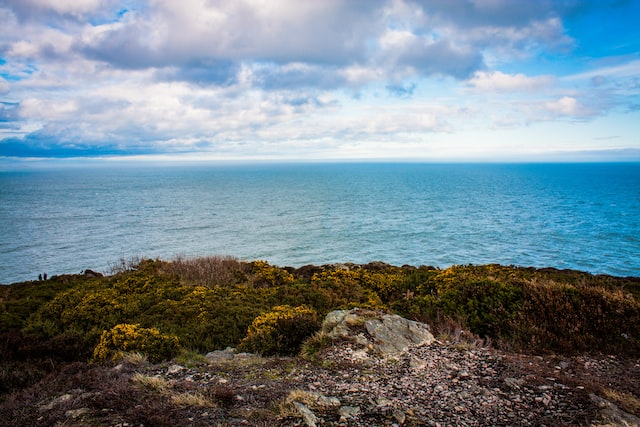
A decent level of fitness is required for all of the trails, as there are steep sections in each one. However, each trail is certainly walkable for young children and able-bodied adults without more than a sturdy pair of shoes. Being Ireland, you should also ensure to dress appropriately for the weather and expect it to be changeable. It’s no harm to check a full day forecast ahead of time.
The main safety issue is taking adequate care near the cliff edges, and staying on the marked trail to ensure you don’t wander into potentially dangerous territory! Happily, the free Discover Howth app can help you to navigate the trails with ease through the miracle of GPS. This handy app also provides expert information on the sights and historical landmarks that can be seen along the way. The app can even send you a notification when you reach a key point of interest.
It’s important to note that there are several areas of Howth Head that don’t have reliable phone service, so do save any maps offline where possible.
Parking
While there is no dedicated car park for the Howth Cliff Walk, there are car parking spaces available in Howth harbour and at Howth DART station. Having said that, Howth is one of the busiest spots for day trippers from Dublin on weekends, so if you are travelling there on a Saturday or Sunday be sure to arrive early to be guaranteed a parking space.
Alternatively, taking the DART to Howth will deliver right to the heart of the village with no car parking headaches. There are also Dublin bus services to Howth that are equally convenient.
Full guide to the Howth cliff walks
Our complete guides to each official Howth cliff walk trail are below, including maps of the trails and the best places to stop and drink in the stunning views.
The Cliff Path loop (Green route)
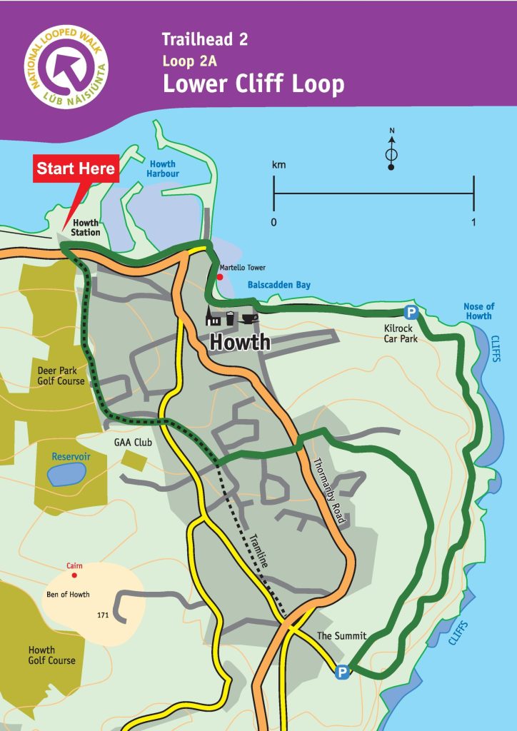
As with all of the four official trails, the Cliff Path loop (following the green markers), starts and ends at Howth DART station.
The trail begins along the harbour promenade, which is a picturesque walk in itself as the village of Howth passes by. At this point, the four trails follow the same route. Once you come to the end of the promenade, follow the path right on to Balscadden Road. Be sure to stop and check out the view over Balscadden Bay beach, a delightful hidden cove that is a local bathing spot. On Balscadden Road you will hike up to Kilrock car park where the path finally meets the actual coastal trail.
The coastal trail route continues for about 3km, before veering right and rising toward the Howth summit car park. Make sure to take a breather on one of the benches along this part of the trail as the views here are spectacular. In particular, we recommend stopping to take in the view at Louis’ Point. Situated 3.4km along the trail, there is a perfect viewing point of the famous Baily Lighthouse, which is still operational today.
Past the car park, the trail continues right for the return leg along a sandy cliff pathway parallel to the cliff trail. The trail meets Thormanby Road once the sandy path ends, at which point you take a left and then an immediate right to head on to Dungriffin Road.
After a few minutes walk on Dungriffin Road, turn right to get back onto the main trail with the blue and red markers and wind your way down into Howth village, back where you started.
The Tramline loop (Blue route)
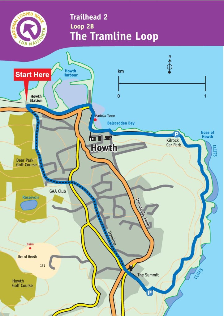
As before, the Tramline loop (following the green markers), starts out at Howth DART station.
With this route, you’ll follow the blue markers along Howth promenade, before turning right on to Balscadden Road and walking to Kilrock car park to meet the coastal trail, the same as with the green route. The next 3km stretch along the coast trail is also the same until you reach the Howth summit car park. As with the green route, take your time along this stretch of the trail to soak up the views!
At the car park, the green route takes Bailey Green Road down to the road junction at The Summit pub. At this point you cross Thormanby Road and enter the tramline path at the entrance with the stone bollards. The tramline path takes you back down to Howth village.
The Black Linn loop (Red route)
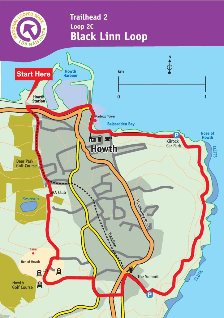
The Black Linn loop (following the red markers) follows the same route as the green and blue loops up until the Howth summit car park. At the car park, the red loop follows the blue loop down to The Summit pub, before taking a left turn to strike out on its own deep into the interior of Howth Head.
At The Summit pub, the red loop turns left along a tarmac road for about 100m, before turning right on to a grass-lined path. Follow this path until it meets Carrickbrack Road. Cross the road and take the path that rises up towards Tweedy’s Hill, before joining onto Windgate Road after a short climb. Take a right and continue on for about 200m and exit by the gate on your left hand side.
The next section of the trail is know as the Black Linn paths, which give this loop its name. The paths wind over the open hills of Howth, and make for great viewing over the peninsula. Along this point the red loop joins the purple loop, before winding down towards Balkill Park housing estate. The red loop finally joins the main trail path with the green and blue markers after entering Balkill Park.
The Bog of the Frogs loop (Purple route)
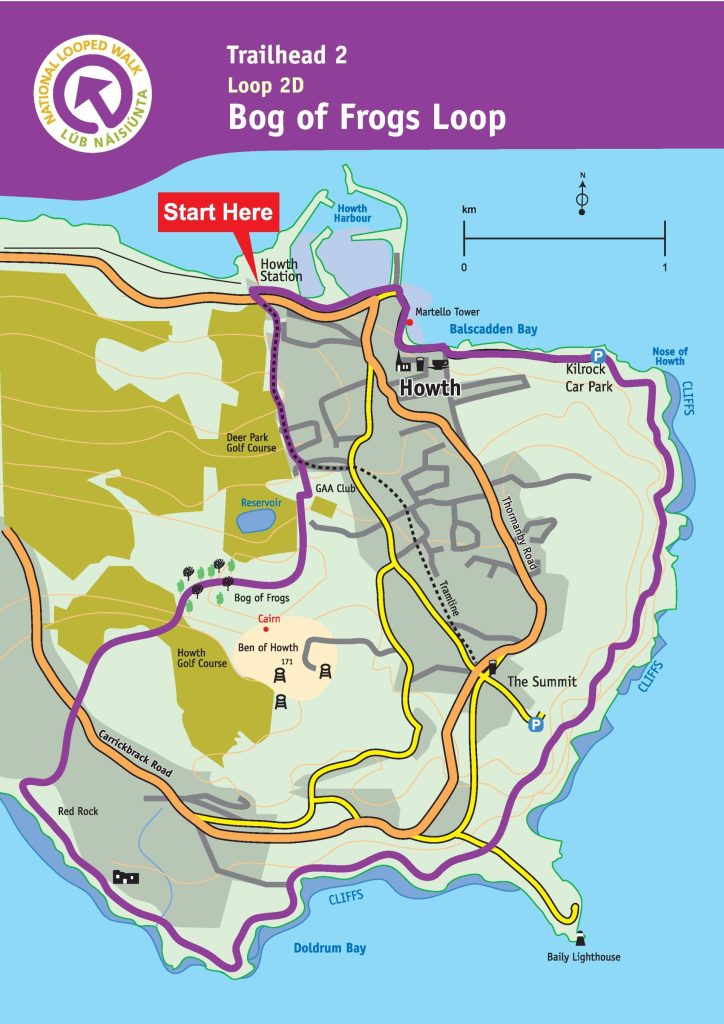
The final official trail, he Bog of the Frogs loop (following the purple markers), is the longest of the four trails. The purple loop starts at Howth DART station and is the same as the other three loops until you reach about 3km along the coast trail. At this point the other loops turn right toward the Howth summit car park, however the purple loop continues straight on until it reaches the road to the Baily Lighthouse. Cross over this road and continue on along the next section of the coast cliff trail for another 3km.
The purple loop takes a right just after the path down to Red Rock beach (this hidden beach is well worth a visit on a sunny day if time allows!). The purple loop then continues onto a grass path up a short hill. Continue along this path before crossing Carrickbrack Road (watch for any traffic as this road can be busy) and entering another trail path.
This trail winds around Sheilmartin Hill, crossing over a golf course on its way. Make sure to keep an eye out for any flying golf balls and an ear out for anyone bellowing fore! Once through the golf course section you enter the Bog of Frogs, from where the purple loop gets its name.
Once through the bog, the purple loop picks up the red loop route to take you back to Howth village.
Though long, the purple loop is without a doubt the best Howth cliff walk to take if you are looking for the full Howth experience.
FAQs about the Howth Cliff Walk
Our favourite walk and the one we recommend is the Cliff Path loop following the green markers, as this is the shortest and easiest official trail to take to see the epic views along the cliff path.
While there is no official Howth cliff walk car park, the best place to park is at Howth DART station as this is the start and end point for all the official trails. However, competition for parking spaces can be fierce so we recommend to get public transport to Howth.

